


Bañugues to Ferrero
Start of the route
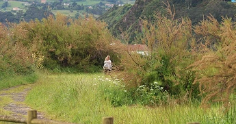
The route begins at the Bañugues Recreation Area, near the beach of the same name, from where we join the sidewalk along the GO-1 highway and walk to the right along a long straight stretch until we reach the small pass at La Ribera, where we’ll see a small wooden bridge that we must cross to continue along the trail.
We’ll encounter gravel and sand along this fairly flat stretch; we’ll pass small clusters of houses and livestock farms in the parish of Bañugues on our left and cross meadows on both sides of the route until we reach the top of the so-called El Monte neighborhood via an asphalt road.
Toward El Canterín
We’ll cross the GO-1 highway, passing a rural inn and a restaurant on our right. Right next to the restaurant’s wall, we’ll find a sign pointing toward Ferrero and Cabo Peñas; a few meters further on, we’ll take the right turn until we reach the signs again pointing left toward Ferrero and Cabo Peñas.
At the next intersection we come to, we’ll turn right, passing right by a house that has a small, very pretty laundry area in excellent condition. Along this path, we’ll see signs again until we come face-to-face with a reddish-colored house on the other side of the road called “Villa Alcazaren,” which we must pass by. We’ll continue along the trail until we reach an area known as El Canterín, where we’ll come to the road connecting Bañugues and Verdicio; to the right, the trail—once again made of gravel and sand—runs parallel to that road toward Ferrero.
The El Rucao and Paraxo Section
We’ll continue along this trail until we reach the sign that says “El Rucao”; right there, we’ll turn right to continue along the path through eucalyptus groves and small meadows. We’ll reach a fork in the trail where we’ll turn right until we come to another fork; there, we’ll turn left, using a house known as Paraxo as a landmark, since that’s the name of the trail.
Intersection of the AS-328
A few meters further on, we come to a ranch on the left side of the road, and shortly after that, the intersection with the AS-328 highway. Right at this intersection, we cross the road, following the sign for Carbayeda; we’ll pass a clay-colored house and, a little further on, turn right until we reach the signs pointing toward Ferrero, Cabo Peñas, and Verdicio. From Carbayeda to the signs pointing toward Ferrero and Cabo Peñas, there are small yellow and white markings painted on a traffic sign and a lamppost; both can be used as landmarks.
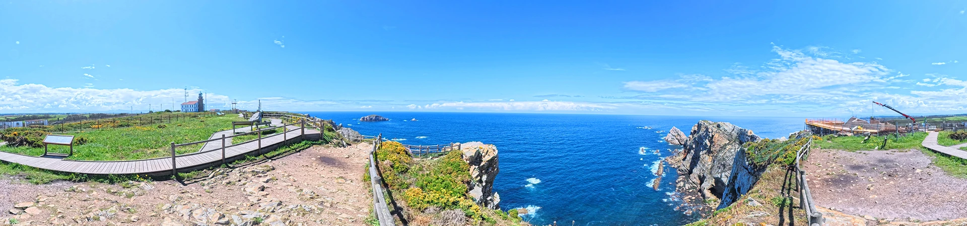
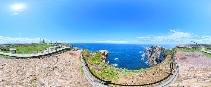
Peñas Coast Lookout
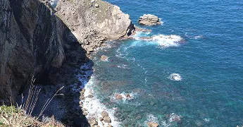
Once we reach the aforementioned landmarks, we’ll turn right, continuing through the La Cai neighborhood and heading toward a rural hotel; once we pass it, we’ll arrive at a beautiful lookout point offering magnificent views of the entire Peñas coastline.
End of the route
We’ll leave the lookout point behind and continue along the trail that runs parallel to the road, with the Peñas Lighthouse already visible in the distance. From this point until the end of the route, we’ll once again encounter a mix of gravel and sand trails and paved paths—without ever stepping onto the AS-328 highway—until we reach a small picnic area at the foot of the lighthouse, where we can take a break.