


Coastal Trail from Cabo Peñas to San Juan de Nieva
The route begins at Cabo Peñas
To begin the route from Cabo Peñas to the San Juan Lighthouse, use as a landmark the building with the glass-enclosed upper section, located a few meters from the Peñas Lighthouse—known as the Peñas Signal Tower—which houses the Cabo Peñas Protected Landscape Interpretation Center.
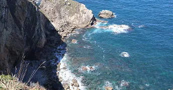
We’ll continue along the trail that runs parallel to the road and, in some sections, heads toward the coastline until we reach the sign for Les Talayes; at that point, we’ll walk past some houses and arrive at a small clearing with wonderful views of the sea and, in the distance, the Peñas Lighthouse.
Section from Les Talayes to Tenrero Beach
We’ll continue along the paved road, passing by the houses until we reach a junction where we’ll see a wooden sign pointing in the direction of both lighthouses (San Juan Lighthouse, Peñas Lighthouse).
Continue toward the San Juan Lighthouse, and you’ll come to another sign pointing toward Bocal. At that point, you have the option to continue along the trail, but we recommend turning right and crossing the meadows along the coastline, which will take you to the cliffs of La Cabaña Beach, where you can see the well-known Tenrero Beach in the distance.
We’ll continue along the coastline until we reach the beach mentioned above, where we’ll walk along the edge of the residential area on the side closest to the sand until we come to a wooden bridge, which we’ll cross. Once we’re on the other side, we’ll take the path that branches off to the right.
Carniciega and Puerto Llampero
We follow the trail, passing Carniciega Beach on our right, and climb for a stretch of the route until we reach the top and enjoy the view from the Aguilera lookout point (nudist beach). We continue along the trail until, shortly thereafter, we come to a junction where we turn right to descend toward Puerto Llampero, one of the most iconic spots on the route, where the famous restaurant El Molin del Puerto—now closed—was located until the storm of 2010.
Otero Cliffs and Xagó Beach
Right where the restaurant’s former parking lot used to be, we take a short climb through some scrubland toward the meadows that once again border the coastal plain. We’ll then reach the trail, where we’ll continue along its left side until we reach the Otero cliffs—a popular spot for paragliding—where we can stop for a moment to “catch our breath” and enjoy the splendid views of Xagó Beach, the largest sandy beach in the municipality of Gozón, stretching 2 km in length and home to a significant dune system.
Section from Xagó to the San Juan Lighthouse
Once we’ve stopped to enjoy the views, we’ll continue along the path and, after a few meters, turn right, skirting around some houses. The trail will take us uphill and then downhill to one of the beach entrances. After walking along the beach, at the opposite end, there’s a small recreational area, and we’ll continue up the road, following it until we reach a bar where there are two possible options; we suggest taking the path that goes uphill on the right.
You can’t miss the trail here, since a little further on we’ll come across a sign pointing to the San Juan Lighthouse.
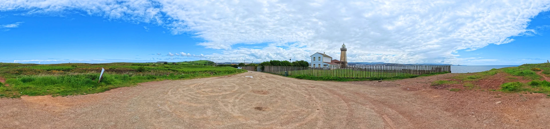
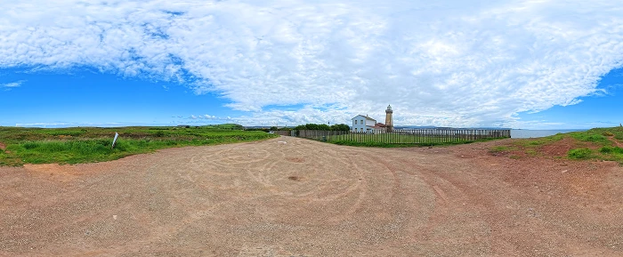
Arrival at the San Juan de Nieva Lighthouse
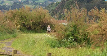
The trail continues northwest along the coastal plain of the Nieva Peninsula, through meadows and patches of gorse and heather; we’ll take the path that runs closest to the coast. From here, you can see a blowhole that shoots water like a geyser when sea conditions are right. In addition to enjoying the coastline, the trail will take you to the San Juan de Nieva battery, which still has the gun emplacements for two cannons.
Finally, we would reach the San Juan Lighthouse, from where we can see the entire Avilés estuary and, to the west, Salinas and the Castrillón coastline all the way to La Deva Island.